IRAWS Information 
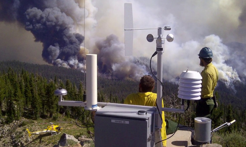
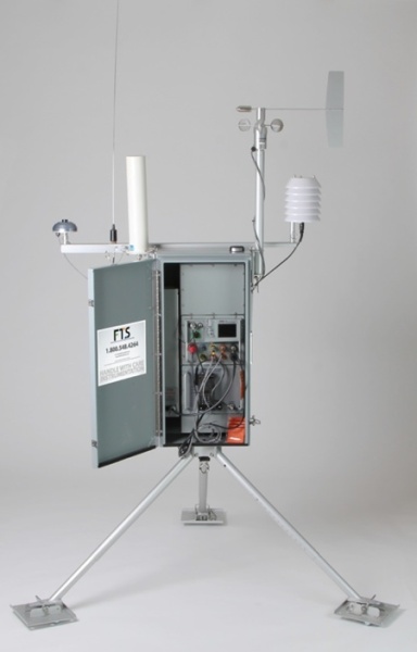
Incident Remote Automatic Weather Stations (NFES #5869 IRAWS kit) are autonomous, portable weather stations that provide near real time observational data.
IRAWS are intended for use on or near the fireline, and can be rapidly relocated as desired by Fire Behavior Analysts (FBAs) or Incident Meteorologists (IMETs) to provide timely weather data. Fire Managers, FBAs and IMETs use IRAWS data to predict fire behavior, prescription burning times, fire weather forecasting, and canyon and ridge top winds. Meteorologists also use IRAWS data to produce spot forecasts and provide fire weather support from all central locations (GACC, NICC).
Currently, 75 kits are available from the Great Basin cache at NIFC.
IRAWS collect, store, and transmit data via multiple communication methods. New data is available immediately via interrogated voice radio. IRAWS can continually monitor weather conditions and automatically broadcast radio warnings when pre-set thresholds are met (e.g. RED FLAG warnings). 15 minute data is also provided via satellite to multiple internet applications (WXx Weather, Mesowest, WIMS, et al.), and made publicly available to the fire management community.
Sensors on IRAWS are calibrated after each deployment. These sensors monitor:
- Relative Humidity
- Average and Peak winds (6 foot level)
- Air temperature
- Fuel temperature
- Fuel moisture
- Precipitation
- Solar radiation
For further information or ordering procedures on the IRAWS units, please contact the Remote Sensing/Fire Weather Support Unit RAWS Coordinator at 208-501-4261.
PRAWS Information
Project Remote Automatic Weather Stations (NFES #5870 PRAWS kit) are autonomous, portable weather stations that provide near real time observational data. PRAWS are intended for use on prescribe burns, and other specialty projects and can be rapidly relocated as desired by trained personnel to provide timely weather data. Fire Managers, Fire Behavior Analysts, and Incident Meteorologists use PRAWS data to predict fire behavior, prescription burning times, fire weather forecasting, and canyon and ridge top winds. Meteorologists also use PRAWS data to produce spot forecasts and provide fire weather support from all central locations (GACC, NICC).
Currently, 15 kits are available from the Great Basin cache at NIFC. PRAWS collect, store, and transmit data via multiple communication methods. New data is available immediately via interrogated voice radio. PRAWS can continually monitor weather conditions and automatically broadcast radio warnings when pre-set thresholds are met (e.g., RED FLAG warnings). 15-minute data is also provided via satellite to multiple internet applications (WXx Weather, Mesowest, WIMS, et al.), and made publicly available to the fire management community.
Sensors on PRAWS are calibrated after each deployment. These sensors monitor the following weather values.
- Relative Humidity
- Average and Peak winds (6-10 foot level)
- Air temperature
- Fuel temperature
- Fuel moisture
- Precipitation
- Solar radiation
For further information or ordering procedures on the PRAWS units, please contact the RAWS Help Desk at 208-387-5475 or at rawshelp@blm.gov
